

 Phoenix 24
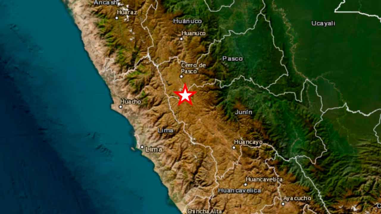
Deep seismic waves expose vulnerabilities across the Andes.
Junín, Peru
A magnitude 6.7 earthquake struck central Peru on November 20, sending powerful tremors across the Andes and reaching as far as Bogotá, Colombia, and Quito, Ecuador. The earthquake occurred at 7:09 p.m. local time, approximately 30 kilometers northwest of Junín, at a depth of 129 kilometers. Although initial reports suggested limited damage, subsequent assessments revealed injuries, damaged homes, disrupted electricity supplies and landslides affecting several regions.
Peru’s National Institute of Civil Defense (INDECI) reported 15 injured people, 127 affected homes and four additional houses rendered uninhabitable in its preliminary assessment updated on November 21. The damage extended beyond Junín into Huánuco, Pasco and metropolitan Lima, where falling construction materials injured a woman in the historic city center. No fatalities had been confirmed in that assessment, although authorities continued inspecting communities and infrastructure.
The earthquake’s considerable depth helps explain why its effects were perceived across such an extensive geographical area. Unlike shallow earthquakes, which can concentrate destructive shaking near the epicenter, deeper seismic events can transmit energy over greater distances. Residents in Lima reported prolonged movement, while people inside taller buildings in Bogotá and Quito also experienced noticeable shaking despite being hundreds of kilometers from the source.
In Junín, emergency personnel documented damage to residential buildings, healthcare facilities and educational infrastructure. The hospital in Pichanaqui was among the affected establishments, while university activities were suspended following reported structural concerns. Authorities also identified damage to religious buildings and community facilities, illustrating the varied consequences of the earthquake across urban and rural environments.
Transportation networks experienced additional disruptions. Falling rocks restricted movement along roads connecting Junín, Pasco and Huánuco, while landslides affected sections of Lima’s Costa Verde and other routes. Electricity interruptions left communities temporarily without service, prompting utility operators and emergency crews to inspect installations and restore affected networks.
Approximately five hours after the main earthquake, Peru’s Geophysical Institute recorded another seismic event of magnitude 5.0 near the same location, at a depth of 127 kilometers. The additional tremor reinforced concerns among residents already unsettled by the initial shaking, although its occurrence does not establish that a larger earthquake will follow.
Peru lies along the Pacific Ring of Fire, where the Nazca tectonic plate descends beneath the South American plate. This geological interaction generates frequent earthquakes of varying magnitudes and depths, making seismic preparedness an essential component of national infrastructure planning and disaster management.
The latest event demonstrates why earthquake risk cannot be assessed through magnitude alone. Depth, distance, local soil conditions, building quality and infrastructure resilience all influence the consequences experienced by communities. A powerful earthquake may produce relatively limited destruction in some locations while exposing serious vulnerabilities elsewhere.
For Peruvian authorities, the immediate priorities remain assisting injured residents, evaluating damaged buildings, restoring essential services and maintaining reliable public communication. As damage assessments continue, the earthquake offers another reminder that effective disaster resilience depends not only on emergency response, but also on prevention, construction standards and sustained investment in public safety.
Beyond the Headlines, Accountability Matters.