

 Phoenix 24
Four thousand years of engineering challenge modern disaster planning.
NORTHERN PERU.
Archaeological evidence from Peru’s northern coast is revealing how ancient communities confronted destructive rainfall, flooding and landslides associated with El Niño long before modern disaster management existed. Recent examinations of Moche settlements and earlier structures in the Chao Valley highlight strategies involving hydraulic engineering, agricultural adaptation and the placement of settlements away from dangerous waterways. These discoveries challenge the assumption that extreme climatic events inevitably led to the collapse of ancient societies. They also raise important questions about what contemporary infrastructure planning can learn from civilizations that repeatedly faced environmental disruption.
The Moche civilization, which flourished along Peru’s northern coastline during the first millennium AD, depended heavily on irrigation networks to sustain agriculture in an otherwise arid landscape. Archaeologist Walter Alva has described how communities responded to destructive flooding by repairing water systems, constructing protective barriers and developing alternative channels. Such measures helped reduce dependence on individual waterways whose failure could threaten food production. Rather than attempting to eliminate environmental uncertainty, these engineering practices reflected an effort to manage recurring hazards.
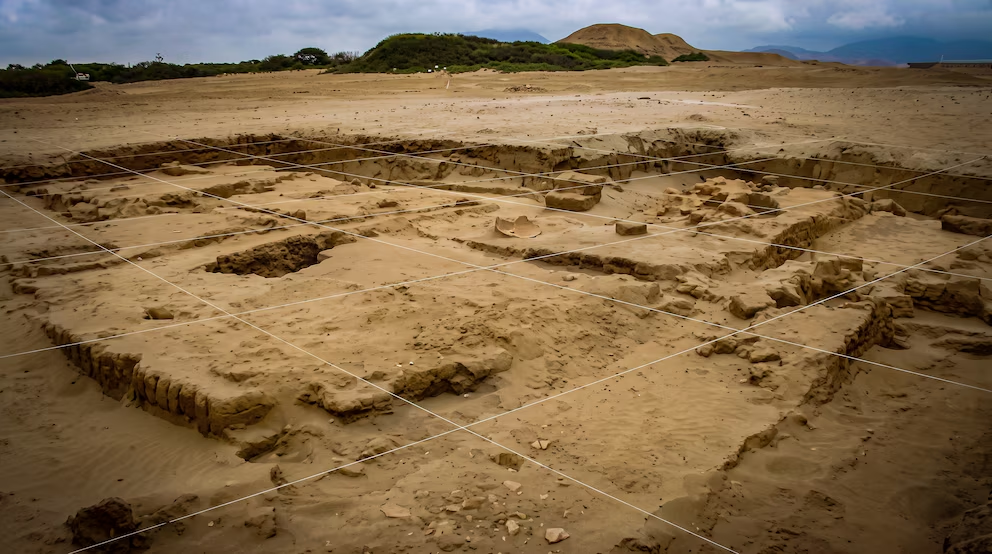
Research at Huacas de Moche provides an additional perspective on the relationship between climatic disasters and social transformation. A study published in Latin American Antiquity examined archaeological evidence associated with an El Niño-like event around AD 600, challenging earlier interpretations that linked the disturbance to the abandonment of the settlement. Excavations instead revealed substantial architectural changes, including the construction of a new temple and the expansion of Huaca del Sol. These findings suggest that environmental shocks could produce institutional and architectural reorganization without necessarily bringing settlement continuity to an end.
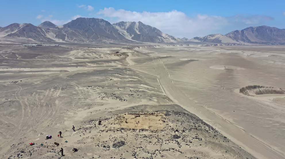
An even older example comes from Salinas de Chao, where archaeologist Ana Cecilia Mauricio and her research team identified massive protective walls dating back approximately 3,800 to 4,000 years. These structures belong to communities that preceded the Moche civilization by many centuries. According to the archaeological investigations, their positioning and accumulated sediment indicate that they were designed to intercept dangerous flows descending from nearby ravines. Their construction demonstrates that organized disaster mitigation existed in prehistoric Andean societies long before contemporary engineering systems.
The broader significance extends beyond archaeology. A 2026 research initiative associated with the Pontifical Catholic University of Peru has explored how geographic information systems, field observations and accessible mapping tools can help identify archaeological locations exposed to flooding and landslides. Combining historical evidence with modern geographic analysis provides a potentially valuable framework for evaluating territorial vulnerability. Ancient experience does not replace contemporary hydrological modeling, but it can reveal where repeated environmental pressures influenced successful or unsuccessful settlement decisions.
The central lesson is not that ancient Peruvians possessed a universal solution to El Niño. Their infrastructure could suffer damage, and societies responded differently depending on geography, resources and political conditions. What survives in the archaeological record is evidence of adaptation, reconstruction and accumulated environmental knowledge. For modern communities confronting extreme rainfall, the enduring question is whether lessons preserved beneath the landscape can inform better decisions before the next disaster occurs.
Beyond the News, the Pattern.