
Early detection becomes a new layer of sovereignty.
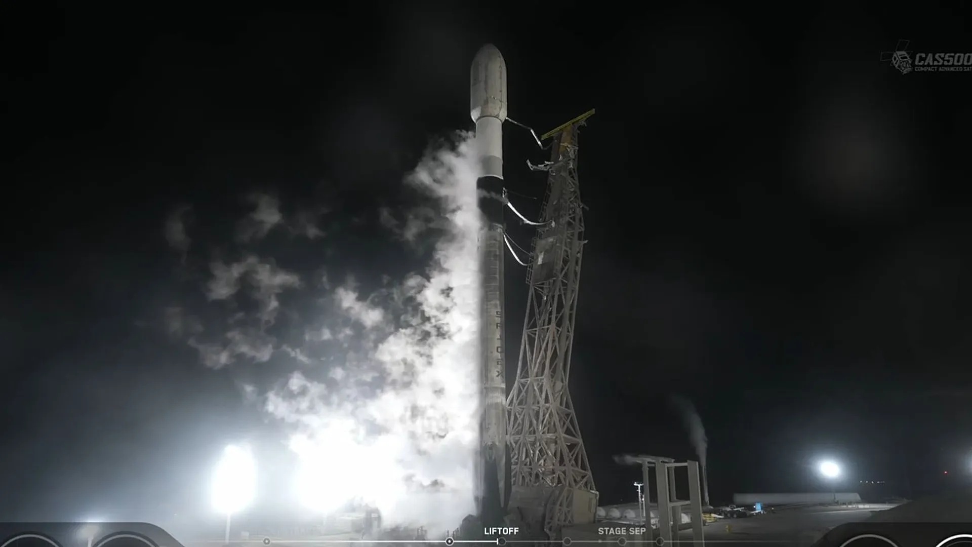
Athens, May 2026. Greece has launched its first thermal satellite capability for early wildfire detection, marking a strategic shift in how Mediterranean states confront climate-driven emergencies. The system is designed to identify heat anomalies from space before fires expand into uncontrollable disasters, giving authorities a wider operational window in a country where summer wildfires have become both an environmental threat and a national security problem. This is not only a technological milestone; it is a sign that climate adaptation is moving into orbit.
The satellites form part of Greece’s broader push to strengthen space-based monitoring, civil protection and disaster response. Their thermal imaging capacity allows the detection of abnormal heat signatures across forests, rural areas and vulnerable landscapes, supporting faster alerts and more precise decision-making on the ground. In practical terms, the value is not simply seeing fire from above, but seeing risk early enough to change the outcome.
For Greece, the timing is critical. The Eastern Mediterranean has become one of Europe’s most exposed climate corridors, where heatwaves, drought, high winds and urban expansion combine to intensify wildfire behavior. Traditional emergency systems, based mainly on ground reports, aircraft and local surveillance, are increasingly insufficient against fires that can accelerate within minutes. Satellite intelligence adds a persistent layer of visibility across terrain that is often difficult, dangerous or too vast to monitor manually.
The initiative also reflects a deeper transformation in European security thinking. Wildfires are no longer treated only as seasonal natural disasters; they are now part of a broader risk architecture involving infrastructure protection, agricultural stability, public health, tourism, insurance systems and state capacity. When fires threaten power lines, ports, villages, archaeological sites or evacuation routes, environmental monitoring becomes a matter of governance and resilience.
The Greek case is especially relevant because it links civil protection with space sovereignty. By investing in its own satellite capabilities, Greece reduces dependence on delayed external data and strengthens its ability to act with national operational autonomy. That autonomy matters in crisis management, where minutes can define whether a fire remains containable or becomes a regional catastrophe.
There is also a symbolic dimension. Greece, historically associated with ancient navigation, maritime power and Mediterranean geography, is now positioning part of its environmental defense in low Earth orbit. The image is powerful: a country shaped by land, sea and fire turning to satellites to protect forests, settlements and critical ecosystems.
Yet technology alone will not solve the wildfire crisis. Thermal satellites can detect risk, but they cannot replace prevention, forest management, local preparedness, emergency coordination or long-term climate policy. Their effectiveness will depend on how quickly data reaches decision-makers, how well agencies integrate alerts and whether response systems are prepared to act before the fire front expands.
The launch therefore represents more than a technical achievement. It signals a new phase in climate governance, where states that fail to integrate data, space infrastructure and emergency planning may fall behind the speed of the crisis itself. In the Mediterranean, the next frontier of wildfire defense may not begin on the ground, but hundreds of kilometers above it.
Información que anticipa futuros. / Information that anticipates futures.