

 Phoenix 24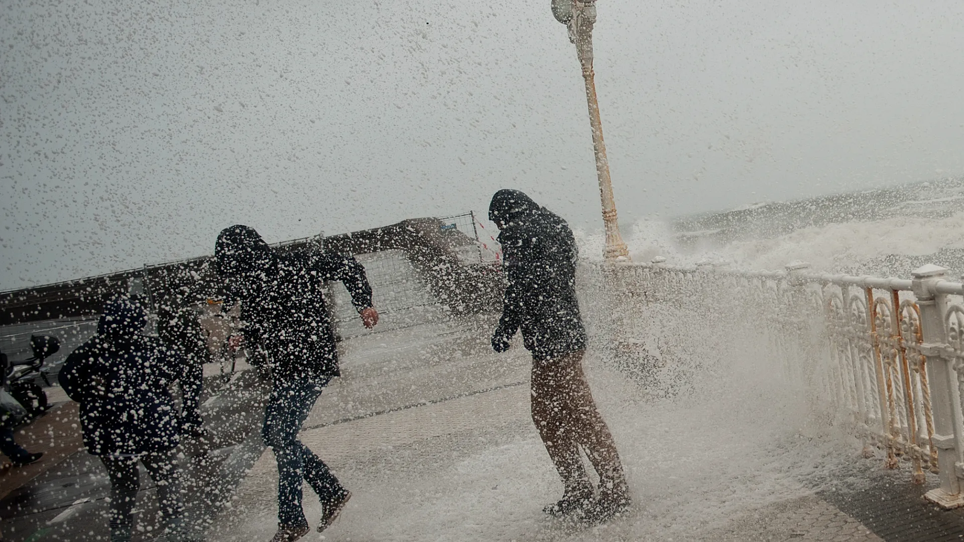
Atlantic weather is redrawing Spain’s risk map.
Santa Cruz de Tenerife, March 2026. Storm Therese has hit the Canary Islands with the kind of force that turns a weather event into a public safety test. Heavy rain, violent wind gusts, and dangerous seas have placed the archipelago at the center of Spain’s immediate meteorological concern, while authorities monitor the system’s slower and more limited approach toward the mainland. The imbalance is striking. What is unfolding in the islands is not merely a passing disturbance, but a reminder that Atlantic volatility continues to expose the outer edges of Spanish territory first and hardest.
According to the outlook described in the coverage, the Canary Islands are facing the harshest phase of the storm, with intense rainfall, gusts that may exceed 80 to 100 kilometers per hour, and waves reaching up to five meters. That combination transforms the threat from a simple inconvenience into a multi front hazard. Flooding becomes more likely, transport networks become more fragile, and coastal exposure intensifies with every hour of sustained wind and rough sea. The activation of weather alerts and preventive measures reflects that broader reality: storms of this kind do not act through a single variable, but through overlapping pressures on infrastructure, mobility, and emergency response.
Some islands are expected to bear a heavier burden than others. Tenerife and La Palma stand out among the most exposed areas, with especially intense rainfall raising the risk of flash flooding, overflowing ravines, and landslides. In elevated zones, even snowfall remains possible, adding another layer to the event’s geographic complexity. This matters because island weather emergencies are rarely uniform. Altitude, terrain, road access, and coastal configuration can sharply alter how a storm behaves from one municipality to the next. In the Canary Islands, geography does not soften meteorological pressure. It often multiplies it.
The broader significance of Therese lies in how it reveals the structural vulnerability of insular territories. Islands depend on continuity of movement, predictable port conditions, stable electricity, and functioning local transport in ways that continental regions often take for granted. When sea conditions deteriorate and winds intensify, the consequences ripple beyond the immediate visual drama of waves and rain. Supply chains become more sensitive, emergency services operate under tighter constraints, and residents in exposed zones can find themselves quickly cut off from normal routines. What looks from afar like bad weather can become, on the ground, a compressed exercise in territorial resilience.
On the Iberian Peninsula, the picture appears more restrained. The mainland is expected to experience a more stable scenario overall, with sunshine dominating in many areas, although some rainfall is still forecast in the southwest, as well as in Ceuta and Melilla, where storms may be locally intense. Over the weekend, the broader expectation is for a calmer pattern, with only occasional precipitation in much of the peninsular territory. That contrast does not make Therese irrelevant to mainland Spain. It simply means the storm is distributing its force unevenly, concentrating the most serious disruption in the Atlantic periphery while delivering only limited secondary effects elsewhere.
That asymmetry is politically and socially revealing. Spain often speaks of its territory as a coherent national space, yet episodes like this show how climate and weather risk are experienced very differently depending on location. For the Canary Islands, storms are not distant headlines but recurring operational realities. The burden of preparedness, adaptation, and response is therefore heavier, more immediate, and more expensive. In that sense, Therese is not only a meteorological event. It is also an illustration of how geography shapes exposure long before public debate begins to frame it as climate resilience.
Experts have urged the public to remain alert as the storm continues to evolve, particularly in the Canary Islands, where the most adverse conditions are expected to persist over the coming days. That warning should not be read as routine caution alone. It reflects the basic truth that modern weather systems, especially in Atlantic corridors, are increasingly judged not only by their peak intensity, but by their duration, their local concentration, and the cascading stress they place on already vulnerable spaces.
Storm Therese may reach the mainland with less force, but its message is already clear. Spain’s weather threats are becoming more territorially unequal, more operationally complex, and more revealing of the fault lines between protected centers and exposed edges. In the Canary Islands, that reality is arriving with rain, wind, and crashing water.
Detrás de cada dato, hay una intención. Detrás de cada silencio, una estructura. / Behind every datum, there is an intention. Behind every silence, a structure.